A deal can look perfect at first. The numbers line up. The location feels right. The plans seem easy to move forward. Then the alta land survey comes in, and things can shift quickly.
This happens more often than people expect in Columbus. A buyer heads toward closing feeling confident about the property. Then something unexpected shows up on the survey. Maybe access crosses into another parcel. Maybe a utility line runs right through the planned build area. Suddenly, what felt simple becomes more complicated.
These issues are not new. They have usually been there for years. The difference is that no one sees them clearly until everything is mapped out together.
Where Easement Problems Really Come From
Easement issues rarely come from a single mistake. More often, they build up over time.
Across many parts of Columbus, properties have changed hands again and again. Businesses expand. Parking areas shift. Neighbors share access without giving it much thought. Over time, the way a property is used can drift away from what was originally recorded.
Take a shared driveway, for example. It may have worked smoothly for decades. Everyone uses it, and no one questions it. Still, the legal right to use that space may not be as clear as it seems. In other cases, utility lines may run through an area that now looks open and ready for development.
Because of this, easement problems often come from everyday use, not obvious errors.
Why These Issues Stay Hidden Until Late
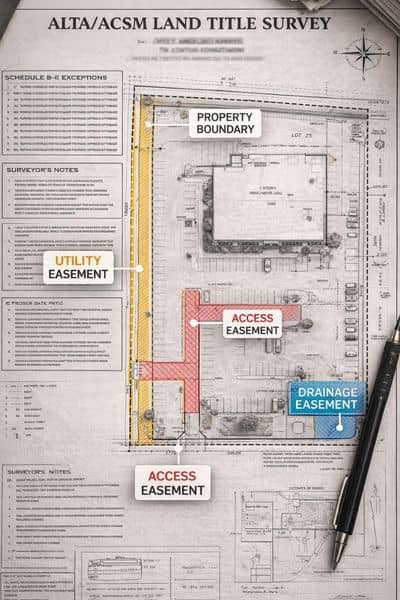
Before closing, most buyers review the title documents. These list easements and other conditions tied to the property, and on paper, everything can look routine.
However, the title only tells part of the story. It explains what exists, but it does not show where those details sit on the ground.
For example, a document might mention an easement, but it will not show if that easement cuts through a planned building area or sits off to the side where it causes no real concern.
Because of that gap, buyers often move forward without seeing how those details affect the site. The property looks usable. The plans feel solid. Then everything gets laid out together, and that is usually when people start to notice how an alta land survey reveals easement issues that were easy to miss before.
How an Alta Land Survey Changes the Picture
An alta land survey does more than confirm boundaries. It brings together the legal records and what is actually on the ground, so you can finally see the full picture.
Once everything is laid out, the smaller details start to stand out. Easements fall into place. Buildings and improvements line up with the boundaries. Access points begin to make more sense.
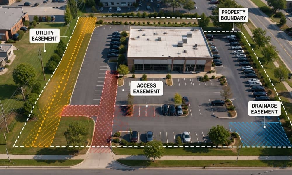
This is usually when issues come into view. A utility easement might run right through the area planned for expansion. A driveway might depend on land outside the property. A building corner might sit closer to the line than expected.
None of this feels obvious at first. Then you see it all together, and it becomes clear what an alta land survey shows on a site—details that are easy to overlook until they are right in front of you.
What Buyers Often Miss at First
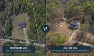
At first glance, most commercial properties look straightforward. The site appears open. Access seems easy. Everything feels usable.
However, appearances can be misleading.
A parking lot may extend into an easement without anyone noticing. An access route may rely on long-standing use rather than legal rights. A neighboring structure may sit closer than expected.
These details often go unnoticed because they do not affect daily use right away. Still, once a buyer plans changes or seeks financing, those same details start to matter.
Why Columbus Properties Need a Closer Look
Columbus has many areas where older properties meet new development. This creates opportunity, but it also adds complexity.
Infill sites often sit between existing buildings. Space is tight, and access may depend on shared paths. Older commercial corridors may carry years of changes that were never fully updated in the records.
Because of this, what worked in the past may not always match current plans.
So even if a property looks clean and ready, its history can still shape how it can be used moving forward.
When Everything Comes Together Before Closing
As closing gets closer, expectations are already set. Plans are in place. Timelines feel tight. Then the survey shows how the site actually works.
This is when easement problems become real.
A layout may no longer fit. Access may not be as simple as expected. Some areas may not be usable at all.
At that point, the focus shifts. Instead of moving forward, the buyer needs to adjust.
That is why timing matters. Seeing these details earlier gives more room to think, plan, and make better decisions.
Understanding the Impact Without Overcomplicating It
Easement issues do not always stop a project. Still, they do shape how a property can be used.
Some problems lead to small changes. Others require bigger adjustments. The key is understanding how the property functions once everything is clear.
That clarity comes from seeing legal information and physical conditions together. Without that connection, decisions rely on guesswork.
Why the Full Picture Matters
In the end, the goal is simple. A buyer needs to understand how the property works, not just how it looks.
An alta land survey helps bring that full picture into view. It shows how boundaries, improvements, and easements interact in real space.
Because of that, it turns hidden details into something clear and usable. And once those details are clear, better decisions follow.
In Columbus, where many properties carry layers of history, that clarity can make all the difference before a deal closes.