
Big changes are coming to one of Cincinnati’s most talked-about neighborhoods. City Council recently repealed the zoning approval for the Hyde Park Square redevelopment after months of heated debate. Most people are focused on what this means for traffic, density, and neighborhood charm. But if you’re a developer, lender, or contractor, the first thing you should be thinking about is your boundary line survey.
When zoning shifts, surveys often need to shift too. This repeal is a perfect example of how political decisions trickle down to the nuts and bolts of property development.
The Story Behind the Repeal
Hyde Park Square is a historic area with a mix of old homes, boutique shops, and community spaces. When a redevelopment plan was introduced, it promised new housing and retail. Yet residents pushed back hard. They argued that the project would create parking chaos, overwhelm narrow streets, and hurt the character of the neighborhood.
Council originally approved the zoning under a “notwithstanding” ordinance, which allows exceptions to existing rules. But after lawsuits, rallies, and months of local pressure, the approval was overturned.
For the community, this means the project goes back to the drawing board. For surveyors and property stakeholders, it means the land itself must be re-checked against the new rules.
Why Zoning Reversals Trigger Fresh Surveys
Zoning rules aren’t just about height and density. They also affect how close a building can sit to a property line, how far utilities must be set back, and even where driveways can connect to a public road.
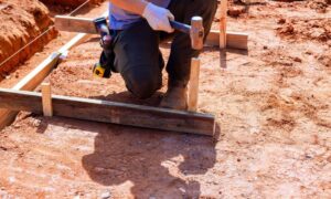
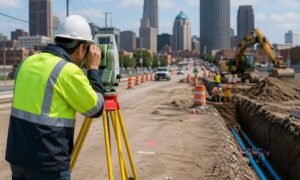
When zoning flips, every one of those details may change. That’s where boundary surveys become essential. Developers need updated plans to confirm new setbacks. Lenders often ask for fresh legal descriptions to protect their investment. Contractors need revised staking so they don’t pour foundations in the wrong spot.
In short, a repeal doesn’t just delay a project—it changes the physical blueprint for how the land can be used.
A Real-World Example: The Ripple Effect

Let’s imagine how this plays out in practice.
A developer buys a lot in Hyde Park based on zoning that allowed a five-foot setback from the property line. Their survey reflects that rule, and they design a multi-unit building to fit the footprint.
After the repeal, the setback requirement reverts to ten feet. Suddenly, the planned building no longer fits. The old survey is out of date, and relying on it would create legal issues with the city and possibly the neighbors.
At this point, the developer must order a new boundary line survey. The surveyor re-maps the property with the current rules, and that updated data becomes the foundation for reworking the site plan.
That one Council decision cascades into weeks of redesign, new lender reviews, and updated construction staking. Without an accurate survey, the project could collapse under disputes or stop-work orders.
How Surveys Protect All Stakeholders
While developers feel the immediate impact, they’re not the only ones affected.
- Lenders want updated surveys before they release funds, ensuring their collateral is protected.
- Contractors rely on survey stakes to guide excavation, foundation work, and utility placement.
- HOAs or neighborhood groups often request surveys during disputes to verify property lines and easements.
- Attorneys and title companies need current plans when handling due diligence or resolving conflicts.
Each group depends on the accuracy of a survey. When zoning changes, outdated data can create expensive mistakes.
Why Projects Are Especially Sensitive
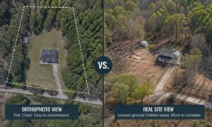
Cincinnati’s older neighborhoods add extra layers of complexity. Streets are narrow, parcels are small, and many lots have easements dating back decades. In places like Hyde Park, even a two-foot error can block a driveway or push a building into violation.
Unlike wide suburban tracts, these dense urban plots leave no room for guesswork. That’s why zoning reversals here hit harder than in sprawling suburbs. A boundary line survey in Cincinnati is more than a formality—it’s the safeguard against projects grinding to a halt.
When to Order a New Boundary Line Survey
Not every zoning change requires a full re-survey, but several triggers should send up red flags:
- The city adjusts setback requirements.
- A plat or subdivision approval gets rescinded.
- Easements or rights-of-way are redrawn.
- A lender requests an updated ALTA or due diligence survey.
- Construction staking no longer matches the approved site plan.
Acting quickly matters. The sooner you update your survey, the sooner architects and engineers can redesign without risking wasted time or money.
Staying Ahead of Future Changes
The Hyde Park case shows how fast public opinion and politics can shift development rules. For anyone investing, it’s a reminder that land surveys aren’t one-and-done. They’re living documents that must keep pace with zoning, infrastructure, and legal decisions.
Instead of waiting for a project to stall, smart developers keep surveyors close at hand. They understand that in an unpredictable market, accurate boundaries are the one piece of certainty you can control.
Final Thoughts
The Hyde Park Square zoning repeal is a headline about community activism and city politics, but for the people building and financing projects, the deeper story is about boundaries. A boundary line survey ensures that your project remains compliant, defensible, and on schedule—even when the rules change overnight.
If you’re a developer, contractor, or lender working, now is the time to review your surveys. The sooner you confirm your boundaries, the smoother your project will move forward in this shifting landscape.