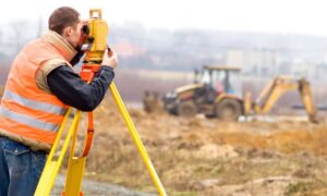
A land surveyor plays a critical role in the success of medical campus development projects. In Cleveland, where healthcare construction is booming, surveyors support access planning, drainage design, and local code compliance. From the very beginning, a land surveyor helps shape safe, efficient, and future-ready sites. This article explains how surveyors make healthcare projects run smoothly—and how they help prevent costly mistakes before construction begins.
Making Sure Medical Campuses Work for the Long Run
Medical buildings work 24/7 and serve thousands of people every week. That means the land must be safe, well-planned, and ready for emergencies.
Surveyors help by:
- Checking property lines
- Finding any problems on the land
- Making sure the land follows zoning and land-use laws
When surveyors work early in the project, it prevents costly mistakes later.
📊 Did you know? Almost 30% of large healthcare projects are delayed because of zoning or title issues. Early surveying can prevent this. (Source: Urban Land Institute, 2023)
Planning Access for Safety and Traffic Flow
Good access is a must on medical campuses. Surveyors help plan safe and clear paths for:
- Ambulances and fire trucks
- Patient and visitor drop-off areas
- Deliveries and service vehicles
They also make sure access points follow city and ADA (Americans with Disabilities Act) rules and fire safety codes.
Planning Drainage and Stormwater Systems
If water isn’t managed well, it can cause flooding or damage the buildings. Surveyors give important data about the land’s height and slope. Engineers use this data to create accurate stormwater drainage design plans that meet both safety and regulatory requirements.
Surveyors help place things like:
- Retention basins (where water collects)
- Pipes under the ground
- Drains in the right spots
This helps protect the land and follow local and federal rules, like those from the EPA.
Making Sure Everything Follows the Rules
Surveyors help place buildings, parking lots, and other features in the right spots. They check:
- Setback distances (how far buildings must be from property lines)
- Buffers near wetlands or flood zones
- Rules for special permits or zones
If the campus will grow in the future, surveyors help plan where new buildings can go and record the changes.
Working with Many Teams
Medical projects need many experts: developers, doctors, engineers, lawyers, and city planners. Surveyors help bring all these groups together with accurate site data.
Surveyor maps and documents support:
- City planning approvals
- Design coordination between teams
- Making sure all plans match city rules
When everyone uses the same data, projects go smoother.
What Surveyors Deliver
A land surveyor in Cleveland, OH gives helpful documents and maps like:

- Boundary surveys and legal maps
- Right-of-way and grading plans
- Digital CAD files for architects and engineers
- Final “as-built” records for permits and inspections
These documents help speed up permits and prevent delays or future problems.
❓Frequently Asked Questions
1. Do medical campuses need special surveys?
Yes. These projects are big and complex, so they need detailed surveys for access, drainage, and compliance.
2. When should a surveyor be involved?
As early as possible—even during site selection. This helps avoid delays later.
3. Can surveyors help with ADA and fire codes?
Yes. Surveyors provide layout data to meet safety and accessibility rules.
4. Do I need a new survey if the land was used before?
Yes. Rules change, and old surveys might not be up to date.
5. What kinds of files do surveyors give?
We provide legal maps, certified plats, CAD files, and as-built drawings. These are used for design, permits, and records.


