Blog
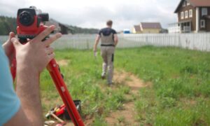
Survey Companies Near Me Spike After Property Mistake
A strange property story in Ohio recently went viral. A homeowner believed he bought a simple piece of land. Later, he learned the purchase included
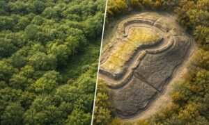
Lidar Survey Lessons from a Hidden Fortress
Recently, archaeologists made big news after they found a 5,000-year-old fortress hidden under thick forest. For hundreds of years, trees and brush covered its walls.

How AI Is Making Land Surveying Faster and Smarter
Land surveying has always depended on skill, fieldwork, and careful measuring. Today, technology helps surveyors work better and faster. Recently, Cleveland began using AI tools

Construction Survey Pricing Explained: What Affects Cost
If you’ve requested a construction survey quote and noticed the prices don’t line up, you’re not alone. Many property owners expect survey pricing to look

New LiDAR Tech Trends Improving Mapping Projects
LiDAR technology doesn’t stand still for long. Over the past few years, it has moved from a niche mapping tool into a core part of

ALTA Survey Cost: How Winter Shutdowns Quietly Spike Prices
Winter in Columbus brings snow, ice, and cold days. Most people expect delays when bad weather hits. However, many do not realize that winter shutdowns