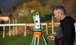
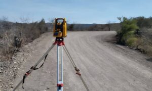
In Cleveland’s tightly packed neighborhoods, every square foot of land counts. Whether you’re installing a new fence, adding a garage, or landscaping your yard, you need to know exactly where your property ends—and your neighbor’s begins. That’s where a boundary survey in Cleveland OH becomes essential. Without one, even a well-intentioned home improvement can lead to legal headaches, costly fixes, or strained neighbor relationships.

What Does a Boundary Survey Include?
A boundary survey is a precise measurement and legal map of your property’s edges. It typically includes:
- Verified property lines and corner markers
- Total lot dimensions and square footage
- Physical features like fences, sheds, and driveways
- Encroachments (structures crossing boundary lines)
- Easements or right-of-way indicators
These surveys are conducted by licensed professionals using both on-site measurements and historical property records.
The Legal Importance of Getting It Right
Boundary surveys hold legal weight in courts, mediation, and title insurance cases. Whether you’re dealing with a fence dispute or planning to sell your home, a current survey protects you by:
- Clarifying ownership boundaries
- Backing your position in disputes
- Helping real estate agents and title insurers validate legal property descriptions
- Supporting permit applications with accurate lot data
Real-World Use Case: Fence and Driveway Conflicts in Lakewood
Consider this real-world scenario: A homeowner in Lakewood, OH, installs a cedar fence based on an outdated plat sketch. Months later, a new neighbor claims the fence encroaches on their land. A boundary survey confirms the fence crosses two feet into the adjacent lot—triggering a legal standoff and a potential removal order.
In densely populated suburbs like Parma, Old Brooklyn, and Lakewood, these kinds of boundary issues are common. A survey would have prevented the problem before construction began.
Before You Build: Why Home Improvements Need Survey Backing
Thinking of adding a garage, patio, or deck? You may be required to submit a current survey with your building permit application. Here’s why:
- Verifies setback compliance
- Ensures the new structure is on your property
- Confirms you’re not building over easements, utilities, or drainage paths
- Helps avoid tear-down orders or denied permits
In neighborhoods like Tremont or Collinwood, where narrow lots and alley access are common, a boundary survey is often the only way to ensure your improvements are legal and future-proof.
Cleveland-Specific Considerations for Boundary Surveys
Cleveland poses unique challenges for surveyors:
- Aging plats and records in older areas like Shaker Heights or Glenville often don’t match physical boundaries.
- Legacy fencing or utility easements can confuse owners about what’s theirs.
- Infill developments and redeveloped zones may show conflicting title data or undocumented land swaps.
A local surveyor familiar with Cleveland’s land history and permitting process is critical for an accurate survey.
When Should You Order a Boundary Survey?
Common situations that call for a survey include:
- Purchasing or selling residential property
- Disputing a neighbor’s fence or driveway
- Planning any permanent improvements
- Updating title insurance coverage
- Clarifying lot boundaries before landscaping or tree removal
If you’re facing any of these scenarios, especially in older neighborhoods or tight-lot areas, a property line survey in Cleveland can offer clarity and prevent costly surprises. While not always legally required, the peace of mind it provides is often worth every penny—especially if you’re investing in property upgrades.
How Much Does a Boundary Survey Cost in Cleveland?
In the Cleveland metro area, most residential boundary surveys cost between $400 and $900, depending on:

- Lot size and shape
- Property age and title history
- Terrain (hilly, wooded, or sloped lots)
- Availability of prior survey records
More complex surveys or legal disputes may push costs higher, especially in historic neighborhoods or urban corridors.
Choosing a Reliable Land Surveyor in Cleveland OH
When selecting a surveyor, look for:
- Ohio licensure and certifications
- Experience in residential and urban Cleveland areas
- Knowledge of local zoning, permitting, and land records
- Solid client reviews or referrals
Avoid hiring based solely on the lowest bid—a quality boundary survey is an investment in legal protection and long-term peace of mind.
Don’t Risk It—Know Your Boundaries
Whether you’re planning to build, buy, or just avoid disputes, a boundary survey in Cleveland OH is one of the smartest decisions a property owner can make. In a city full of historic quirks and dense development, knowing exactly where your land begins and ends isn’t just helpful—it’s essential.
Before you build or buy—survey.
FAQs
1. Do I need a boundary survey before building a fence?
Yes. It’s the best way to avoid crossing into a neighbor’s lot or violating setback codes.
2. Can I use an old survey?
Only if nothing has changed and it matches current title records. Otherwise, get a new one.
3. Can I find my property lines online?
Tools like the Cuyahoga County GIS Viewer offer estimates, but they’re not legally accurate.
4. Who pays for a boundary survey during a home sale?
It’s negotiable. Buyers often pay for due diligence, but sellers may include it to speed closing.
5. Is my survey filed with the city or county?
Not always. Keep your own records. Only plats or subdivision maps are typically recorded.
6. How long does a survey take in Cleveland?
Standard surveys take 1–2 weeks. Older or more complex properties may take longer.


