Thinking of Building? Here’s Why a Topographic Survey Should Come First
Before any shovel hits the ground, smart builders and homeowners take one essential step: getting a topographic survey.
Whether you’re building a new home, a commercial warehouse, or preparing land for development, a topographic survey ensures your plans align with the real-world landscape. Skipping this step can lead to costly surprises—like drainage issues, failed inspections, or last-minute design changes.
So, do you really need a topographic survey before building?
Yes—and here’s why.
What Is a Topographic Survey, in Simple Terms?
A topographic survey is a detailed map of your property that shows the elevation, contours, and physical features of the land—both natural and man-made.
It includes:
- Ground elevation at multiple points
- Hills, slopes, and flat areas
- Trees, rocks, drainage ditches
- Retaining walls, driveways, fences
- Existing structures or utilities
Unlike a boundary survey, which defines property lines, a topo survey tells you how the land behaves—vital info for architects, engineers, and builders.
Why Builders and Homeowners Need It Before Construction
Skipping a topographic survey before building can lead to expensive mistakes.
A topo survey helps:
- Identify drainage paths to prevent water pooling or flooding
- Design proper grading to support foundations and driveways
- Avoid design errors from flat drawings that ignore slopes
- Ensure site plan accuracy for permits and inspections
🏠 Real-Life Example:
A homeowner in suburban Ohio designed their new build based on a flat lot assumption. When construction began, they discovered a subtle slope causing runoff toward the home. Fixing it required regrading, drain tile installation, and thousands in added costs—all avoidable with a topo survey.
When Is a Topographic Survey Required?
Topographic surveys are often required, especially in these situations:
- Before submitting building permit applications
- When grading or excavating a lot
- For stormwater or drainage plan approval
- During land subdivision or site development
- Before designing a septic system or driveway on uneven land
Some counties and municipalities—especially in Ohio—require one as part of zoning or stormwater compliance.
Who Uses Topographic Surveys During the Build Process?
Topographic surveys are essential for the entire design-build team:
- Architects – Use the data for designing homes or buildings that fit the terrain
- Engineers – Use it for grading, utilities, and drainage systems
- Surveyors – Use it for construction layout and staking
- Contractors – Use it to plan excavation and material movement
What Does It Cost?
In Ohio, the average cost of a topographic survey ranges from $800 to $2,500, depending on:
- Size and complexity of the property
- Terrain – flat land is faster to survey than wooded hills
- Existing documentation – properties with no records take longer
- Urban vs rural location – access and setup time varies
💡 Tip: Bundling a boundary survey with your topo survey can sometimes reduce total cost.
How Long Does It Take to Get a Topographic Survey?
Most topo surveys take 1 to 2 weeks, but expect delays during:
- High-construction seasons (spring/summer)
- Poor weather conditions (rain or snow)
- When permit deadlines are tight—plan early
How Is a Topographic Survey Performed?
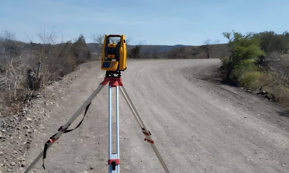
Surveyors use tools like:
- Total stations and GPS equipment to collect elevation points
- Drones or LiDAR scanners for large or hard-to-reach sites
- CAD and GIS software to create detailed maps and models
The final product is a topographic map you or your design team can use for planning, permitting, and engineering.
Can You Use a Previous Topographic Survey?
Sometimes—but be cautious.
Use an older topo survey only if:
- The land hasn’t changed (no grading, clearing, or construction)
- The local jurisdiction accepts it for permitting
- It was done recently—within the past 2–3 years
If there’s any doubt, ask your surveyor to update or verify the data.
A Small Step That Protects Your Big Investment
Building without a topographic survey is like designing a house blindfolded. Sure, the blueprint might look great—but if the land doesn’t match the plan, you’re in for costly delays and revisions.
A topographic survey before building is a one-time investment that saves time, money, and frustration. Whether you’re constructing a dream home, a retail space, or a rural retreat, understanding your land is the foundation of everything.
FAQs
Q1: Can I skip the topo survey if my lot looks flat?
Not a good idea. Even slight slopes can affect drainage or structural stability.
Q2: Will the city or county require a topo survey?
Often yes—especially in areas with strict stormwater or elevation rules.
Q3: How detailed is a topographic survey?
Very. It includes contours, spot elevations, and major landscape features.
Q4: Does it include property boundaries?
Not by default. You’ll need a boundary survey too—but they can often be done together.
Q5: Is a topo survey the same as a site plan?
No. A site plan uses data from a topographic survey to design your build.
Q6: Who provides topographic surveys?
Only licensed land surveyors or engineers with surveying experience.

