Ohio’s real estate scene is busy again—and not just with new construction. With talk about changing property taxes, developers across the state are moving faster than ever. In cities like Dayton, this has led to a rush of land splits, re-plats, and new site plans. To keep up, many are turning to one powerful tool: drone surveying.
When land values and taxes start shifting, timing becomes critical. Lenders need fresh data, cities need accurate site maps, and developers can’t afford delays. Drone surveying is helping everyone move faster and stay accurate.
The Tax Debate That Started the Rush
Over the past few weeks, the debate about ending or capping property taxes has become a major topic. Some people believe it could make housing more affordable and attract investment. Others worry it might affect local services.
For developers, one thing is clear—uncertainty means they need to act fast. Many are checking property boundaries, updating plats, and submitting plans before new rules take effect. In places like Dayton, that means more survey requests than usual.
This surge of activity has made one thing obvious: traditional surveying methods can’t always keep up.
Why Fast and Accurate Surveys Matter
In development, every day counts. Tight budgets and loan deadlines make timing crucial. Developers can’t wait weeks for survey results—they need to know the land’s exact shape now.
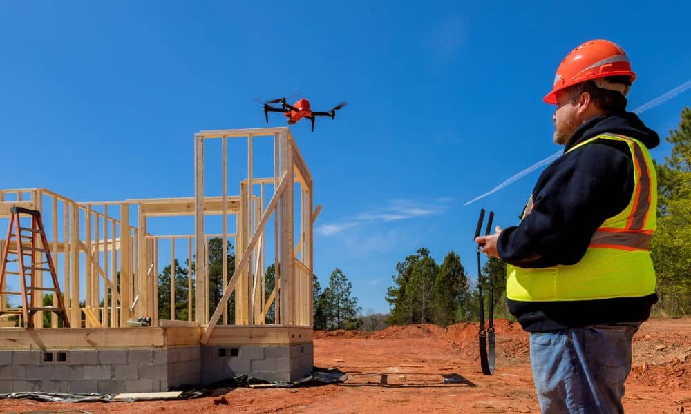
That’s where drone surveying comes in. In one short flight, licensed surveyors can capture thousands of measurements, showing terrain, slopes, drainage, and structures. What once took days on the ground now takes hours in the air.
Accuracy doesn’t get lost in the process. Drones use advanced positioning systems and ground markers to match the precision of traditional tools. The big advantage is speed: drone data gives engineers and planners the information they need to start designing right away.
From Tax Maps to Real-World Terrain
Here’s how drone surveying helps developers.
Imagine a builder who owns several acres of land. They want to divide it into smaller parcels before any new tax rules take effect. Before they can submit a plan, they need a map that shows the true boundaries, elevations, and drainage paths.
A drone can capture everything from above—trees, fences, pavement, and slopes—and turn it into a digital map. That map helps engineers plan grading, driveways, and future structures.
By combining aerial data with ground checks, surveyors give a complete, current picture of the site. Developers can move forward with confidence and fewer delays.
How Drone Data Helps Lenders Too
It’s not just developers who benefit. Banks and title companies also depend on surveys to confirm property details before approving loans.
When land values change, lenders often request updated site information to make sure everything matches the records. Drone surveying makes that process faster. Aerial photos and elevation data show any new improvements or changes that could affect value.
For lenders, seeing real and recent images builds trust. It reduces risk and keeps financing on schedule—something everyone appreciates when deadlines are tight.
Drone Surveying in Dayton’s Development Scene
Around Montgomery County, drone surveying has become part of everyday planning. Builders use it to map open tracts, sloped areas, and sites ready for design. Even small developers rely on it for quick topographic data before starting a project.
Instead of waiting weeks for traditional fieldwork, surveyors can fly a drone in minutes. Within a day, engineers receive maps with contours, surface models, and accurate elevation data, ready for use in design software.
Drone surveys adapt easily to different project sizes. Whether it’s a subdivision, a warehouse site, or a single commercial lot, drones give developers clear, up-to-date visuals they can rely on.
What Happens After the Flight

Drone surveying might look simple, but it follows a careful process. Surveyors plan each flight based on weather, location, and airspace rules. They set up control points on the ground so the aerial data aligns with real-world coordinates.
Once the flight is complete, the images are processed into a high-quality composite photo. This becomes part of a digital elevation model showing every height and slope.
Engineers then use the data to plan grading, drainage, and construction layouts. Because licensed surveyors oversee the work, the final results meet the accuracy needed for permitting and design.
What Property Owners Can Do
You don’t need to be a large developer to use drone surveying. Homeowners and small property investors can also benefit.
If you’re planning to build, refinance, or sell land, consider getting a current survey that includes aerial data. Licensed surveyors who use drones can capture every detail faster, helping you plan improvements or avoid boundary mistakes.
Drone surveys are especially useful for large or uneven lots, rural tracts, and areas near creeks or flood zones. The aerial view helps spot problems early—before they turn into costly issues during construction.
The Bottom Line: Drone Data Keeps Projects Moving
The discussion over property taxes may take time to settle, but development won’t slow down. As builders and landowners prepare for change, drone surveying gives them an advantage.
By providing quick, precise data, surveyors help projects stay on track, reduce waiting times, and prevent costly surprises. In cities like Dayton, that means faster growth and better planning—no matter what happens with taxes.
Whether you’re dividing land, starting construction, or planning your next project, a drone survey can help you make smart, data-driven decisions. It’s the simplest way to keep your plans accurate, efficient, and ready for whatever comes next.
