Aerial Mapping: What Orthophotos Miss
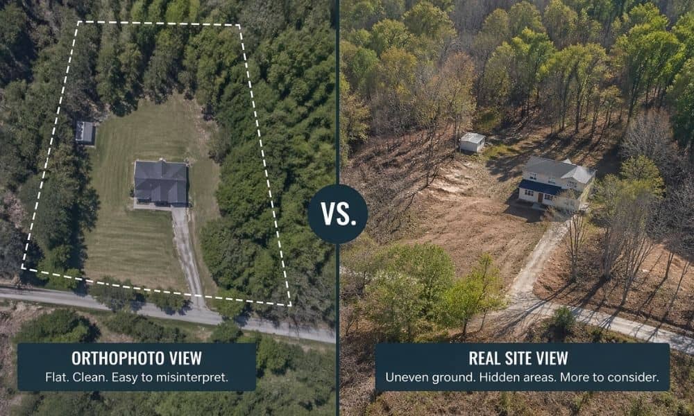
You open a map of your property in Columbus. The image looks clean. The lot seems simple. It feels like you already understand the space. Then work starts, and things don’t match what you saw. That happens more than people expect. Public orthophotos help, but they only show a flat picture. They don’t show the […]