Welcome to ALTA Survey Ohio

Your Final Stop for Your ALTA Survey Needs!                              Contact us today for a free quote!

This site is intended to provide you with information on ALTA Surveying in Ohio. If you’re looking for a Ohio Land Surveyor, you’ve come to the right place. If you’d rather talk to someone about your land surveying needs, please call our toll-free number at (888) 808-9783 today. For more information, please continue to read.

ALTA Survey Ohio

Land Surveyors are professionals who make precise measurements to determine the size and boundaries of a piece of real estate.  While this is a simplistic definition, boundary surveying is one of the most common types of surveying related to home and land owners. If you fall into the following categories, please click on the appropriate link for more information on that subject:

ALTA Survey Ohio services:

    1. I need to know where my property corners or property lines are. (Boundary Survey)
    2. I have a loan closing or re-finance coming up on my commercial property. (ALTA Survey)
    3. I need a map of my property with contour lines to show elevation differences for my architect or engineer. (Topo Survey – ALTA Survey plus Table A Item 5.)
    4. I’ve just been told I’m in a flood zone or I’ve been told I need an elevation certificate in order to obtain flood insurance or prove I don’t need it. (Flood Survey)
    5. I’m purchasing a lot/property for a commercial use. (ALTA Survey – Item 5 and/or Item 11b may also need to be discussed.)
    6. I’m purchasing a larger tract of land, acreage, that hasn’t been subdivided in the past. (Boundary Survey)
author avatar
Surveyor

More Posts

Cleveland Ohio skyline and commercial buildings—ALTA surveys are essential for urban property transactions.
alta survey
Surveyor

Don’t Skip the ALTA Survey: It Could Save Your Investment

In the rush of closing a commercial real estate deal, it’s easy to overlook one critical step—the ALTA survey. But in a city like Cleveland, where aging infrastructure, legacy easements, and fast-moving development projects intersect, skipping this survey can be a costly mistake. Whether you’re buying, financing, or redeveloping a

Read More »
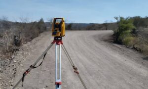
Surveying equipment set up on a rural site in Ohio to conduct a topographic survey, capturing elevation and land features before construction planning.
land surveying
Surveyor

Do You Need a Topographic Survey Before Building?

Thinking of Building? Here’s Why a Topographic Survey Should Come First Before any shovel hits the ground, smart builders and homeowners take one essential step: getting a topographic survey. Whether you’re building a new home, a commercial warehouse, or preparing land for development, a topographic survey ensures your plans align

Read More »
Two land surveyors conducting a site survey in front of a commercial property in Ohio using modern equipment
alta survey
Surveyor

When You Need an ALTA Survey: Buyer & Lender Guide

Buying or refinancing commercial real estate in Ohio? You may need an ALTA survey—but when exactly is it required, and who asks for it? If you’re a property buyer, lender, attorney, or title company, understanding when an ALTA survey is required in Ohio is key to avoiding surprises and delays.

Read More »

LiDAR Mapping Solves Elevation Challenges in Ohio

LiDAR mapping is rapidly transforming how elevation challenges are addressed in Ohio’s land development projects. With the state’s mix of flat farmland and rolling terrain, builders and planners often face grading issues, drainage concerns, and costly construction delays due to inaccurate elevation data. By using LiDAR mapping early in the

Read More »

An Introduction to LiDAR Mapping for Land Projects

Land development today depends on accurate data. Whether you’re building roads, planning a new subdivision, or preparing for a large infrastructure project, you need to understand the land you’re working with. One of the most advanced tools used for this is LiDAR mapping. What Is LiDAR Mapping? LiDAR stands for

Read More »

How a Land Surveyor Supports Logistics Park Design in Toledo

Toledo is quickly becoming a hub for shipping, logistics, and warehousing thanks to its strong access to highways, rail lines, and the Great Lakes. But building successful distribution hubs takes more than just land—it requires strategic planning from the ground up. A land surveyor plays a key role by providing

Read More »