Land development today depends on accurate data. Whether you’re building roads, planning a new subdivision, or preparing for a large infrastructure project, you need to understand the land you’re working with. One of the most advanced tools used for this is LiDAR mapping.
What Is LiDAR Mapping?
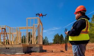
LiDAR stands for Light Detection and Ranging. It works by sending out laser pulses from a drone or aircraft toward the ground. These laser signals bounce back and create a 3D picture of the land below.
LiDAR data shows:
- The shape and elevation of the land
- Buildings, trees, and other surface features
- Fine details like ditches, slopes, and ridges
It’s fast, detailed, and extremely accurate—especially when paired with GPS and onboard sensors.
How LiDAR Differs from Traditional Surveying
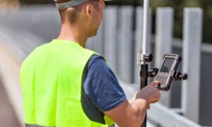
Unlike traditional land surveys that use ground crews with tripods and total stations, LiDAR can scan large areas in a short time. Some key differences include:
- Speed: Drone LiDAR can map large areas in hours
- Detail: Millions of data points create a high-resolution image
- Vegetation Penetration: Laser pulses can go through tree cover
- Elevation Accuracy: Ideal for grading, drainage, and slope studies
That’s why many engineers and developers turn to LiDAR mapping in Cincinnati OH and nearby areas like Dayton OH when working on fast-moving projects that involve complex terrain.
Common Uses of LiDAR Mapping in Land Projects
LiDAR is used in many industries. In land development and surveying, common uses include:
- Creating topographic surveys for site planning
- Designing drainage systems and identifying low spots
- Planning roadways and utility lines
- Checking volumes for earthwork and excavation
- Supporting environmental and floodplain analysis
Because it collects data quickly and accurately, LiDAR is especially useful for areas that are wooded, uneven, or hard to access.
Why Accuracy Matters in Ohio Projects
Ohio’s land includes forests, rivers, hills, and open space. In cities like Cincinnati and Dayton, development often happens in areas with elevation changes and limited visibility. Accurate mapping helps:
- Avoid design errors
- Speed up permitting
- Meet zoning and environmental requirements
That’s why more professionals now rely on drone-based LiDAR mapping. It gives them confidence in every measurement.
Choosing a LiDAR Mapping Partner in Ohio
Not all LiDAR services are the same. For best results, look for a provider who:
- Uses FAA-certified drone pilots
- Has a licensed surveyor overseeing the process
- Understands local regulations and permitting needs
- Delivers usable files like CAD drawings, point clouds, and contours
Whether your project is in urban Cincinnati or a rural site near Dayton, working with a local team ensures faster service and fewer delays.
Modern Surveying for Smarter Land Use
LiDAR is changing the way we plan and build. It gives developers, engineers, and surveyors better data, faster results, and fewer surprises. Whether you’re mapping farmland, planning infrastructure, or preparing for large-scale development, LiDAR mapping helps you make smarter decisions.
FAQs
1. What makes LiDAR better than GPS-only surveys?
LiDAR collects millions of points quickly and captures elevation and surface detail that GPS alone cannot.
2. How accurate is drone-based LiDAR mapping?
Most systems offer accuracy within a few centimeters—ideal for planning and engineering.
3. Can LiDAR be used in wooded or hard-to-access areas?
Yes. LiDAR lasers can scan through tree branches and capture the ground surface.
4. Is LiDAR data accepted by permitting authorities in Ohio?
Yes. When done by licensed professionals, LiDAR maps meet most engineering and permitting standards.
5. How long does a typical LiDAR mapping project take?
Most jobs can be flown in a day and delivered within a week, depending on project size.

